| Hunua Ranges | |
| Starting point | Papakura Autobahn |
| Distance | 73.9 km |
| Gravel | Optional |
| Petrol | Available at Hunua, Clevedon, Whitford |
| Toilets | Available at Hunua Falls, Clevedon, Magazine Bay |
| Lunch | Maraetai or Whitford |
This is the bare bones of a route on the western side of the Hunua Ranges and around the Maraetai coast. There are several suggestions for side trips, some involving gravel and a bit of exercise, which will help you personalise the route to your own taste.
There are twisty roads, coastal scenery and good cafes on offer here. If you like waterfalls or dams, these can be added to the route.
Suggested route
| Notes | Directions | Alternatives |
|---|---|---|
| Papakura BP at the Motorway Service Centre | ||
| ↓1.5 km | ||
| Drury motorway exit. Turn left onto Great South Road. | ||
| ↕0.5 km | ||
| Turn right at the roundabout onto Waihoehoe Road. | ||
| ↕2.6 km | ||
| Turn right at the T-junction onto Drury Hills Road. | ||
| ↕1.5 km | ||
| Turn left at the T-junction onto Fitzgerald Road. Fitzgerald becomes Quarry Road and then Ramarama Road. | ||
| ↕2.1 km | ||
| Turn left onto Ararimu Road | About 800 metres along Ararimu Road, turn onto Pratts Road, then immediately park next to the cemetary on the left. There's a path on the north side of the cemetary which takes you to Maketu Waterfall. It's a bit steep and can be muddy, and will take you 5-10 minutes walk each way. The parking spot is gravel and can be a bit tricky. | |
| ↕6.3 km | ||
| Turn left at a crossroads to stay on Ararimu Road. The road ahead is Dunn Road - don't take that. | Ararimu road turns to the right after 3.7 km. To shorten your route slightly, continue on Gelling Road straight ahead instead, which connects to Hunua Road a bit further north. | |
| ↕9.4 km | ||
| Turn left at the T-junction onto Paparimu Road. Paparimu Road becomes Hunua Road. | After 2.0 km on Paparimu Road, you can turn right onto Moumoukai Road, which takes you into the Hunua Ranges Regional Park. After 1.4 km, Otau Road goes to the left. This is unsealed, and has a carpark immediately on the left. For a group ride, stop at the carpark, and walk to see Wairoa Falls (about 100 metres further along the road) and Wairoa Dam. There's a gate across the road, and if it's open you can ride a couple of km closer to the dam, but there's limited places to park. The walk from the end of the road to the dam is a 3.9 km loop. If you wish to continue along Moumoukai Road for another 6 km (which is unsealed) you can get to the Upper Mangatawhiri Dam which is similar to the Wairoa Dam but a little larger. | |
| ↕8.9 km | ||
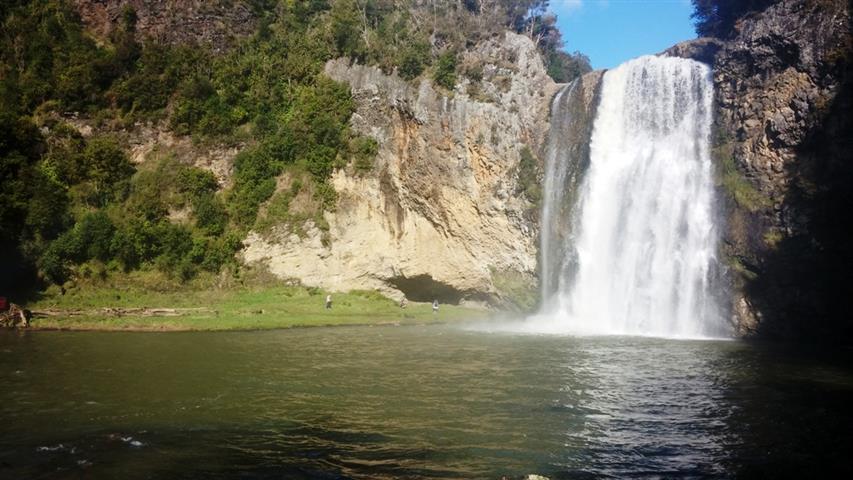
| Turn right onto White Road. | After 1.3 km on White Road, you can take Falls Road on the right for 2.3 km to Hunua Falls. This is all sealed. There's a large carpark and toilets. | |
| ↕2.4 km | ||
| Turn right at a T-Junction onto Sky-High Road, which becomes Monument Road | ||
| ↕10.0 km | ||
| There is a petrol station in Clevedon, and public toilets are on the left as you enter the roundabout. There are several cafes in Clevedon. | Turn right onto the Papakura-Clevedon Road, and continue straight through the roundabout 400 m further on onto North Road. |
Duder Regional Park is on the right about 9.6 km from the Clevedon roundabout. There's a 600 m gravel access road to the carpark, where there are toilets. There are walking tracks, but possibly not much of interest to the average motorcyclist. |
| ↕11.0 km | ||
|
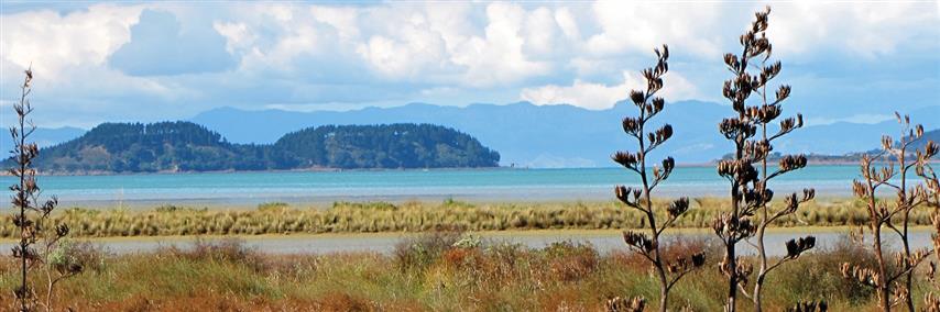
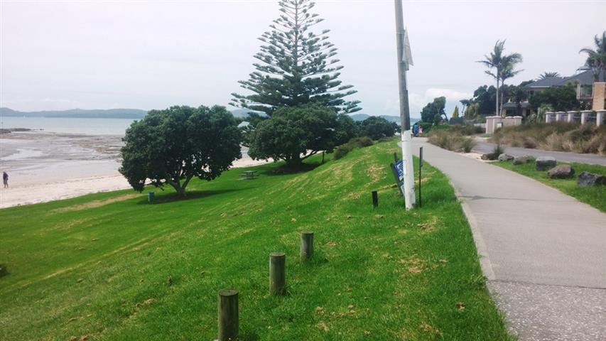
This area is called the Pohutukawa Coast. There are public toilets at Magazine Bay, 2.7 km along Maraetai Coast Road. There are cafes a little further along the road at Maraetai. A petrol station is on Maraetai Drive. |
When you reach the water's edge, follow the road to the left, when it becomes Maraetai Coast Road and then Maraetai Drive and Whitford-Maraetai Road. | To visit Omana Regional Park, turn right onto Campbell Road just after the petrol station (5.1 km from reaching the water's edge), then right again onto Craig Road and left onto Alexander Avenue. This takes you to a T junction with Omana Esplanade. Follow this to the left for public toilets. The road connects to the main Whitford-Maraetai Road. There are areas with cobblestones, which are a little disconcerting to ride over. |
| ↕9.9 km | ||
| At the roundabout, turn left (first exit) to stay on Whitford-Maraetai Road. | ||
| ↕9.1 km | ||
| There's a petrol station as you approach Whitford, and other places to eat here.The Miranda Farm Shop and Cafe at 1107 Miranda Road is a possible place to stop for lunch. | In Whitford, go right at the roundabout (third exit) onto Wharf Road. On the left is a steep driveway down to the Lime Tree Cafe, recommended as the lunch stop. Sometimes the car park is full and it's wiser to find parking at the top of the driveway. | |
| After lunch, there are three main ways from Whitford back towards Auckland. At the Whitford roundabout, turn right from Wharf Road (third exit) onto Whitford Road, which takes you to Botany Downs, or go straight through (second exit) to Whitford Park Road, which leads to a second roundabout. Turning right (third exit) here will take you on Sandstone Road to Manukau or Otara, and continuing through the roundabout (second exit) will take you through Brookby to Manarewa. |
To ride this route in reverse, start at the Auckland Botanic Gardens carpark in Hill Road, Manurewa, take Stratford, Alfriston, Brookby and Whitford Park Roads to Whitford, where you take the third exit on the Whitford roundabout towards Maraetai. You'll finish at Drury, where there are a number of suitable places to pull over for an end-of-ride debrief.
Photos
 |
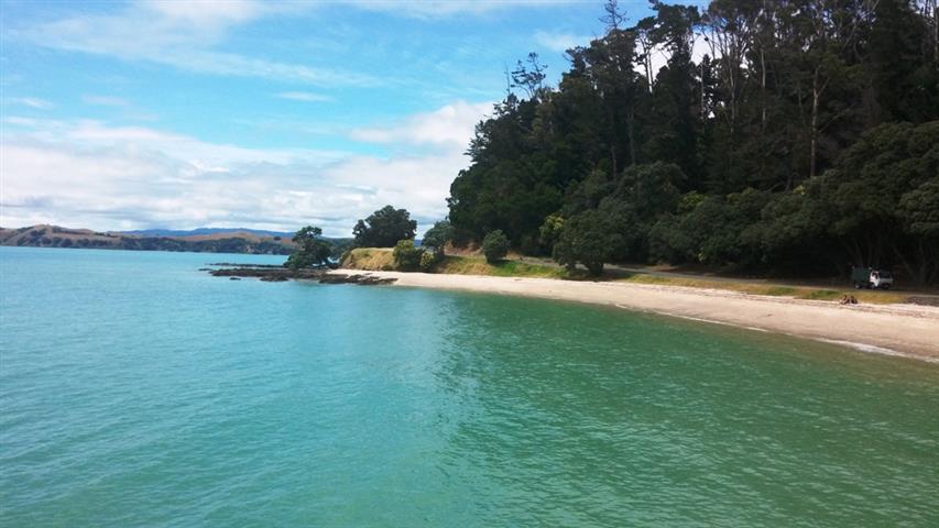 |
| Hunua Falls | Duder Regional Park |
 |
 |
| Magazine Bay | Omana Regional Park |