Raglan
|
|
| Starting point |
Papakura Autobahn |
| Distance |
198 km |
| Gravel |
A few km (alternative route) |
| Petrol |
Available at Mercer, Glen Murray, Ngaruawahia, Pokeno |
| Toilets |
Available at Mercer, Ngaruawahia, Taupiri, Pokeno |
| Lunch |
Hopin Stopin Cafe in Taupiri |
This ride takes in the best of the sealed northern Waikato backroads, with one half of the ride on the west side of the Waikato River, and the other half on the east side. The recommended cafe for lunch is lunch is the Hopin Stopin Cafe in Taupiri, right on the bank of the river, which has a long outdoor table with a roof giving shade which is ideal for groups of 10-15 motorcyclists.
Suggested route
| Notes | Directions | Alternatives |
|---|
| |
Papakura BP at the Motorway Service Centre. |
|
| |
↓23.9 km |
|
| Mercer has a petrol station, and there are public toilets in the food court area. |
Mercer motorway exit. Turn right onto Koheroa Road. |
|
| |
↕180 metres |
|
| |
Turn left onto Mercer Ferry Road, and cross the Waikato River. |
|
| |
↕5.2 km |
|
|
| |
Turn left onto Morrison Road. |
|
| |
↕2.5 km |
|
| |
Turn right onto Clark And Denize Road. |
|
| |
↕5.2 km |
|
| Petrol is available at Glen Murray on Highway 22. |
Turn left onto Highway 22. |
For the alternative route which has a few km of gravel, follow Highway 22 for 1.9 km and turn left onto Churchill Road. Follow Churchill Road for 17.0 km, the last bit being gravel. Turn left onto Glen Murray Road. |
| |
↕15.5 km |
|
| |
Turn left onto Glen Murray Road. |
|
|
| |
↕12.6 km |
|
| |
Turn right onto Rotongaro Road. |
|
|
| |
↕10.9 km |
|
| |
Turn right onto Hetherington Road. |
|
| |
↕300 metres |
|
| The Rotongaro Hall is on this intersection and is a good point to have a rest stop, although there are no facilities here. |
Turn left onto Waikokowai Road. |
|
| |
↕9.8 km |
|
| |
Turn right onto Rotowaro Road. |
|
| |
↕11.1 km |
|
|
Turn left onto Waingaro Road. Follow this road into Ngaruawahia. In Ngaruawahia, you cross the Waipa River and the road veers to the right, but continue straight ahead on Waingaro Road. The road then twists to the left and back to the right to reach Great South Road (also called the Thermal Explorer Highway). |
|
| |
↕16.1 km |
|
| There is a petrol station, several cafes, and public toilets in Ngaruawahia. Turn right onto Great South Road to find any of these. |
Turn left onto Great South Road. |
|
| |
↕400 metres |
|
|
Turn left onto Old Taupiri Road. |
|
| |
↕5.0 km |
|
| There's a BP petrol station on the right at this intersection. |
Turn left onto Great South Road. |
|
| |
↕2.1 km |
|
|
Hopin Stopin Cafe is on the left. After lunch, continue north. |
|
| |
↕500 metres
|
|
|
Take the third exit on the roundabout onto State Highway 1B. |
Take the first exit instead if you just want to head back to Auckland on State Highway 1 after lunch. |
| |
↕500 metres |
|
|
Take the first exit on this second roundabout onto Orini Road. |
|
| |
↕6.0 km |
|
|
Turn left onto Rutherfurd Road. |
|
| |
↕8.9 km |
|
|
Turn left onto Tahuna Road. |
|
| |
↕3.2 km |
|
|
Turn right onto Waiterimu Road. |
|
| |
↕500 metres |
|
|
Turn left onto Waikare Road. |
|
|
| |
↕12.6 km |
|
|
Turn right onto Waerenga Road. |
|
|
| |
↕3.0 km |
|
|
Turn left onto Falls Road. Falls Road becomes Coalfields Road. |
|
|
| |
↕17.7 km |
|
|
Turn left onto Kopukue Road. |
|
|
| |
↕950 metres |
|
|
Turn left onto State Highway 2. |
|
|
| |
↕3.0 km |
|
|
Take the Mangatangi exit and turn right (second exit) at the roundabout. |
|
|
| |
↕300 metres |
|
|
Turn left onto Rawiri Road. Rawiri Road becomes Mangatawhiri Road. |
|
|
| |
↕4.0 km |
|
|
Turn left onto Koheroa Road. |
|
|
| |
↕8.5 km |
|
|
Veer right onto Kellyville Road. |
|
|
|
| |
↕2.8 km |
|
|
Turn right onto Pioneer Road. |
|
|
|
| |
↕2.0 km |
|
|
Merge onto State Highway 1. |
|
|
|
| |
↕450 metres |
|
| End at Pokeno and debrief over an icecream. |
Take the Pokeno exit. |
|
|
To ride this route in reverse, follow the motorway south from Papakura to just south of Pokeno, and take the Pioneer Road exit. The rest of the route should be easy to follow in reverse. At the end, when you cross the Waikato River at Mercer, turn left to take State Highway 1 north.
Photos
 |
 |
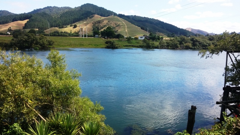
| Hopin Stopin Cafe is right on the edge of the Waikato River |
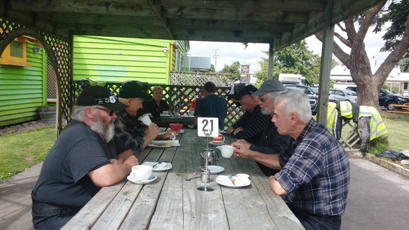
Lunch at the Hopin Stopin |
 |
|
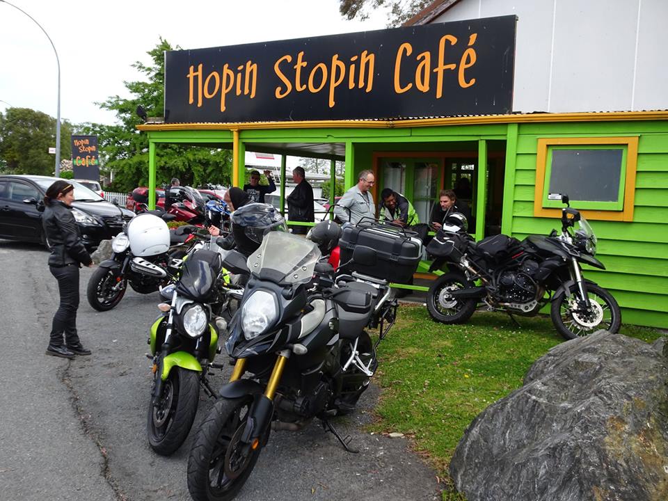
| A view of the cafe from the road |
|