Port Albert
|
|
| Starting point |
Warehouse Covered Carpark, Albany |
| Distance |
91-122 km (one-way) |
| Gravel |
18-33.5 km, optional |
| Petrol |
Available at Riverhead, Kaukapakapa |
| Toilets |
Available at Kaukapakapa, Port Albert Wharf, Atui Creek Regional Park, Birds Beach |
| Lunch |
Port Albert General Store |
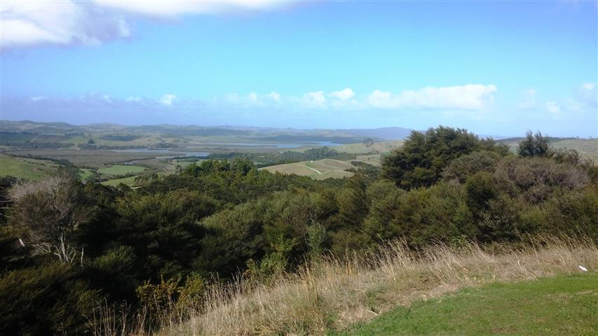
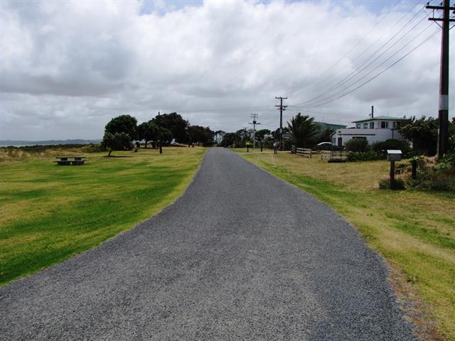
Port Albert is a small community west of Wellsford. It was settled by a group of non-conformist Baptists in 1862. They had grand plans for a city here on the southern shore of the Kaipara Harbour, but it was too isolated to develop. From State Highway 16 there are two roads marked as going to Port Albert; the southernmost is gravel, and the one closer to Wellsford is a nice sealed country road. Port Albert General Store doubles as a cafe and has very good fish and chips. A bit further west is Atui Creek Regional Park, with great views over the Kaipara Harbour. The road turns to gravel as it goes west, but there's a very attractive little community at Birds Beach, which looks at its best when the tide is in. A loop road goes back to the seal, and having done that much gravel, why not go back to SH16 on the southern gravel road?
Suggested route
| Notes | Directions | Alternatives |
|---|
| |
Warehouse covered carpark on Coliseum Drive. Head towards Albany Expressway. |
|
| |
↓200 m |
|
|
Turn right onto Albany Expressway. This becomes Dairy Flat Highway. |
|
| |
↕3.9 km |
|
| |
Turn left just past the G.A.S. station into Coatesville-Riverhead Highway. |
|
| |
↕11.2 km |
|
|
|
Turn right at the roundabout onto Riverhead Road. |
|
| |
↕0.9 km |
|
|
Turn right onto Deacon Road. |
|
| |
↕1.1 km |
|
|
Turn right onto Old North Road. |
|
|
| |
↕8.4 km |
|
| |
Turn right onto Peak Road. |
|
|
| |
↕12.9 km |
|
| Kaukapakapa is about 1 km along SH16, and there are public toilets as you approach it. There's a petrol station in the middle of Kaukapakapa. |
Turn right onto State Highway 16. |
|
| |
↕44.1 km
|
|
| Port Albert Road is the second road marked "Port Albert". The first is Wharehine Road, and it's gravel! |
Turn left onto Port Albert Road |
|
| |
↕6.8 km |
|
|
Continue straight ahead onto Wharf Road |
|
| |
↕1.3 km |
|
| There are toilets at the end of Wharf Road. Halfway along the road is the Port Albert General Store, which is the only cafe in the area. |
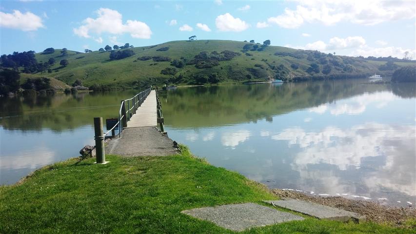
Wharf Road terminates at a jetty and boat ramp on the Topuni River, which flows into the Kaipara Harbour. |
Return to Auckland from here if you want a short ride or want to avoid all gravel roads. Wellsford is about 4 km further north on SH16 if you would prefer other lunch options or an alternative way back to Auckland on SH1. |
| |
↕1.3 km |
|
|
Return along Wharf Road, then turn right at the top of the hill onto Wharehine Road which becomes Run Road. |
|
| |
↕10.7 km |
|
|
Turn right onto the Atiu Creek Regional Park access road (gravel road). |
|
| |
↕1.0 km |
|
| There are toilets at the Atiu Creek carpark. |
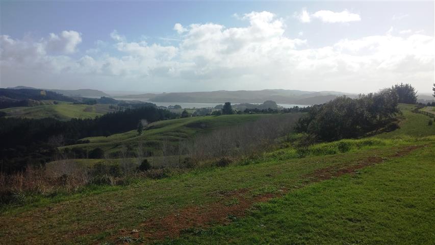
From the Atiu Creek carpark, there are views on both sides, and some bush/forest walks. |
|
| |
↕1.0 km |
|
|
Return along the access road, and turn right onto Run Road. The road turns from sealed to gravel. |
Riders who wish to avoid gravel roads should turn left onto Run Road and return at this point. |
| |
↕10.5 km |
|
|
Turn right onto Journey's End, which becomes Birds Beach Road. |
|
| |
↕6.0 km |
|
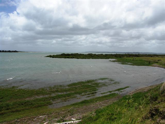
| There are toilets at Birds Beach. |
Birds Beach Road finishes at a boat launch ramp. Return along Birds Beach Road and Journey's End. |
|
| |
↕4.8 km |
|
|
Turn right onto Okahukura Road. |
Alternatively, continue on Journey's End and Run Road for a shorter return home. |
| |
↕8.3 km |
|
|
Continue on Run Road, which becomes sealed. |
|
| |
↕15.3 km |
|
|
Turn right onto Wharehine Road (gravel road). |
If you've had enough gravel, continue on the sealed road towards Port Albert, which is a longer route. |
| |
↕6.2 km |
|
|
Reach the junction with SH16. Turn left to go to Wellsford, or right to head back to Auckland. |
|
Photos