| Awhitu Peninsula | |
| Starting point | Papakura Autobahn |
| Distance | 145 km |
| Gravel | None, apart from 100 m of unsealed driveway at the Manukau Heads Lighthouse. |
| Petrol | Available at Waiuku, Matakawau, Karaka |
| Toilets | Available at Waiuku, Matakawau, the Lighthouse, Awhitu Regional Park, and almost all the bays on the peninsula. |
| Lunch | Waiuku, or bring a picnic |
Awhitu is a rural peninsula south-west of Auckland, between the Manukau Harbour and the Tasman Sea. The main road running up it is a nice country road, and there are many small bays at the northern end which make a reasonable destination for a ride. There's also the Awhitu Regional Park, and the Manukau Heads Lighthouse as possible destinations. All the destinations mentioned here have toilets. There are no cafes on the peninsula, so riders need to either bring a picnic lunch or go back to Waiuku to eat.
Side roads running parallel to the main road are narrow sealed roads which can be a little unpredictable with animal effluent and loose gravel sometimes making the surface difficult. There's also the prospect of meeting a milk tanker around the next bend. I suggest the side roads are suitable for more experienced riders.
Suggested route
| Notes | Directions | Alternatives |
|---|---|---|
| Papakura BP at the Motorway Service Centre. | ||
| ↓1.5 km | ||
| Drury motorway exit. Turn right onto State Highway 22. | For a longer and more interesting way of getting to Waiuku, see the Aka Aka route. | |
| ↕7.2 km | ||
| Turn right onto Glenbrook Road. | ||
| ↕20.7 km | ||
| There are toilets in a rest area on the right by the first roundabout. | Turn right onto King Road, and continue veering right through the two roundabouts just past this intersection. | |
| ↕10.6 km | ||
| Turn right onto J Renall Road, which becomes Te Toro Road, then Lees Gully Road and then Given Road. | Alternatively, continue along Awhitu Road to avoid the side roads. | |
| ↕8.5 km | ↕12.4 km | |
| Turn right onto Cemetery Road. | ||
| ↕1.4 km | ||
| Cemetery Road merges with Pollok Wharf Road just before a T junction. Turn right at the T junction onto Awhitu Road. | Follow Awhitu Road around a sharp left-hand bend to rejoin the detailed route. | |
| ↕4.3 km | ||
| West Coast Road goes off to the left 1.6 km north of Pollok and leads to Hamilton's Gap, a small beach on the Tasman Sea. Access to the beach is difficult because of a shallow lagoon blocking the way. There are toilets at the beach carpark. | Turn left onto Kemp Road, which becomes Manukau Heads Road, then Hartner Road. | If you are not going to the lighthouse, follow Kemp and Manukau Heads Road for 7.7 km then turn right into Boiler Gully Road. |
| ↕12.0 km | ||
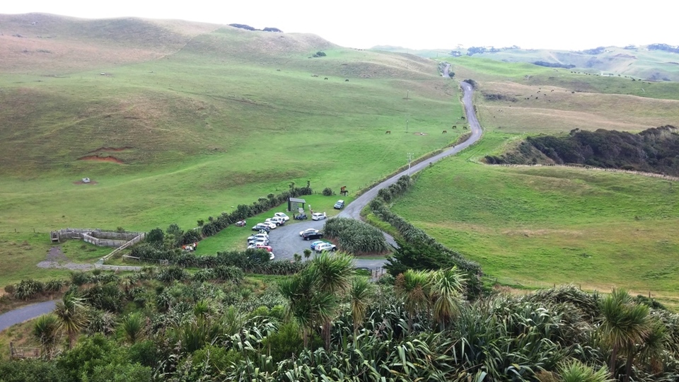
| There are toilets at the lighthouse carpark. Next to the lighthouse is a viewing platform over the Manukau Heads. A donation of $2 is requested if you enter the lighthouse. | Turn left down the gravel driveway to Manukau Heads Lighthouse. | |
| ↕4.3 km | ||
| Return along Manukau Heads Road and turn left on Boiler Gully Road. | ||
| ↕3.5 km | ||
| Merge right onto Orua Bay Road. | If you turn left onto Orua Bay Road, possible destinations are Orua Bay or Wattle Bay, both with views across the harbour. | |
| ↕0.5 km | ||
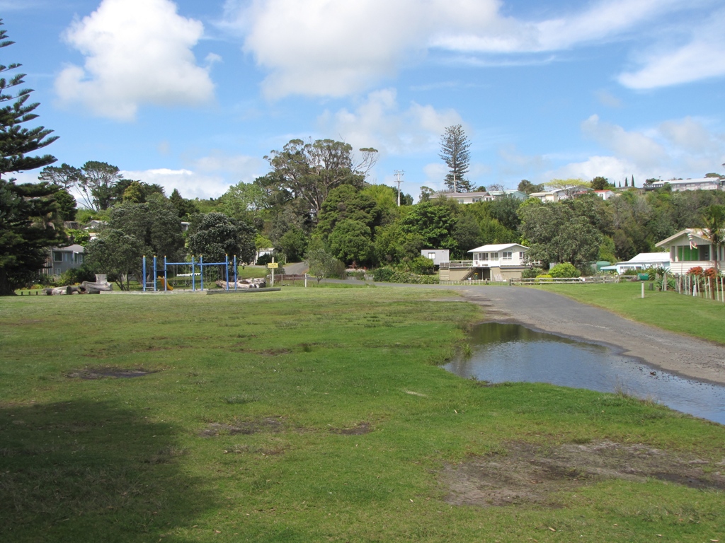
| Turn right onto Tram Gully Road, which becomes Awhitu Road | If you turn left onto Grahams Beach Road, you can visit Big Bay or Grahams Beach, both with harbour views. | |
| ↕4.8 km | ||
| There are a petrol station and public toilets at Matakawau. | Continue south through Matakawau. |
Turn left at Brook Road to go to Awhitu Regional Park. There is a large carpark here making this a suitable destination for large rides. There are toilets. Turn left at Matakawau and go for 5 km along Matakawau Road to Matakawau Point, where there is a reserve with toilets. |
| ↕16.7 km | ||
| Turn left onto Kohekohe-Kariotahi Road. Where Boundary Road crosses Kohekohe-Kariotahi Road, go straight ahead (veering slightly to the right) - this can be a confusing intersection. | Stay on Awhitu Road if you want to avoid the side roads. Wiuku is 13 km away on the main road. | |
| ↕12.3 km | ||
| Turn left at the T-junction onto Kariotahi Road, which becomes Constable Road. | Turn right at the T-junction to go to Kariotahi Beach on the Tasman Sea. The carpark at the beach is gravel, and there are some rough areas in the carpark. There are toilets. | |
| ↕5.5 km | ||
| There are lots of cafes in Waiuku. I like Cafe Karma on Bowen Street. However, if there are more than 10-12 people, you might find there's not enough room here. For larger groups, turn right at the roundabout and right again at the next one, go along the main street and turn at the first left into Kitchener St, then immediately right into a driveway, which opens into a large carpark with Porter Bro's Cafe (9 Kitchener Rd). |
Just before the roundabout is a large carpark on the right, which is a suitable place to park and walk to a cafe in Waiuku's main street. After lunch, go around the first roundabout then left on the second roundabout, and turn left onto Kitchener Road which becomes Collingwood Road then Glenbrook Road |
|
| ↕12.8 km | ||
| Turn left at the roundabout onto Kingseat Road. | ||
| ↕3.5 km | ||
| Turn right at the roundabout to stay on Kingseat Road, which becomes Linwood Road after a sharp left turn followed by a sharp right turn. Continue on Linwood Road until you reach the Southern motorway, about 14 km after the roundabout. |
Since the ride is a figure-eight loop, you can ride either or both parts in reverse. I suggest following the above route from Papakura to Waiuku, and at the end from Waiuku to Karaka. Riding the route in between in reverse is straightforward.
Photos
 |
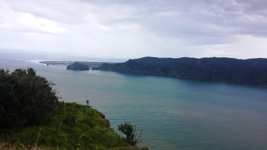 |
| Manukau Heads Lighthouse carpark | Manukau Heads viewed from the lighthouse |
 |
|
| Grahams Beach |