| Aka Aka |
|
| Starting point |
Papakura Autobahn |
| Distance |
87 km |
| Gravel |
None |
| Petrol |
Available at Glenbrook, Waiau Pa |
| Toilets |
Available at Hoods Landing, Clarks Beach |
| Lunch |
Cafe Sole, Clarks Beach |
There is a network of roads south of Waiuku and Pukekohe but north of the Waitato River. Some are flat and straight, while others are hilly and twisty. All mentioned here are sealed. This is a good place for a shorter ride.
Suggested route
| Notes | Directions | Alternatives |
|---|
| |
Papakura BP at the Motorway Service Centre |
|
| |
↓1.5 km |
|
| |
Drury motorway exit. Turn right onto State Highway 22. |
|
| |
↕750 metres |
|
| |
Turn left onto Great South Road. |
|
| |
↕1.7 km |
|
|
| |
Turn right onto Runciman Road. |
|
| |
↕4.0 km |
|
| |
Turn right onto Tuhimata Road. |
|
| |
↕4.9 km |
|
| |
Turn right onto Crown Road. |
|
| |
↕0.7 km |
|
| |
Turn left onto State Highway 22. |
|
| |
↕1.4 km |
|
| |
Turn right onto Heights Road. |
|
| |
↕2.3 km |
|
| |
Turn right onto Gun Club Road. |
|
| |
↕3.6 km |
|
| |
Turn left onto Pahumatoe Road. |
|
| |
↕2.9 km |
|
|
Turn right onto Waiuku Road. |
|
| |
↕1.8 km |
|
|
Turn left onto Aka Aka Road. |
|
| |
↕9.8 km |
|
| |
Turn right onto Otaua Road. |
For an alternative toilet stop, go 4.9 km along Aka Aka Road, turn left onto Elbow Road, then follow that for 900 metres. Take an unmarked slip road on the left to find the Elbow Waterski Club on the bank of the Waikato River. |
| |
↕5.0 km |
|
|
Turn left onto Hoods Landing Road |
|
| |
↕2.0 km |
|
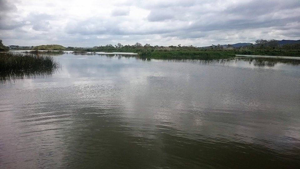
| A toilet stop on the banks of the Waikato River |
Hoods Landing. |
|
| |
↕2.2 km |
|
| |
Return north on Hoods Landing Road, and turn left onto Maioro Road. |
|
| |
↕3.6 km |
|
| |
Turn right onto Thomson Road. |
|
| |
↕0.9 km |
|
| |
Turn right onto Robertson Road. Robertson Road becomes Whiriwhiri Road. |
|
| |
↕8.2 km |
|
| |
Turn left onto Waiuku-Otaua Road. |
|
| |
↕1.4 km |
|
| |
Turn right onto Cemetery Road. Cemetery Road becomes Columbo Road. |
|
| |
↕2.6 km |
|
| |
Turn left onto Kitchener Road. |
|
| |
↕0.3 km |
|
| |
Turn right onto Cornwall Road. |
|
| |
↕1.1 km |
|
| |
Turn right onto Waiuku-Glenbrook Road, which becomes Glenbrook Road. |
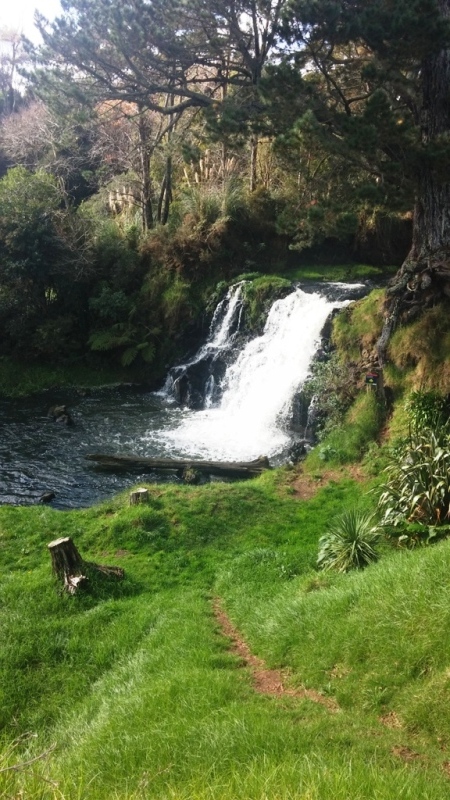
3.5 km along Waiuku-Glenbrook Road, turn left into Waitangi Falls Road and follow that for 1 km to see a small waterfall and swimming hole. There's a path down to the water just past the carpark. The road goes on to a turning circle at the edge of the Waiuku River. |
| |
↕11.0 km |
|
| |
Turn left at the roundabout onto Kingseat Road. |
|
| |
↕1.3 km |
|
| |
Turn left onto Waiau Pa Road. Waiau Pa Road becomes Clarks Beach Road. |
|
| |
↕10.5 km |
|
| |
Turn right onto Torkar Road. |
Alternatively, go straight ahead onto Stephenson Road, then turn right at Seaway Road which is the first side road on the right. |
| |
↕0.6 km |
|
| |
Turn left onto Seaway Road. The cafe is on your right. |
|
To return to the Southern Motorway, return along Clarks Beach Road. About 4.5 km after leaving Clarks Beach, turn left onto McKenzie Road and follow the road as it becomes Kingseat Road and then Linwood Road.
To ride this route in reverse, take State Highway 22 from Drury, continue past the turn onto Great South Road, and turn right onto Glenbrook Road. When you reach the roundabout, continue through it and turn left onto Cornwall Road 1.1 km later.
Photos
 |
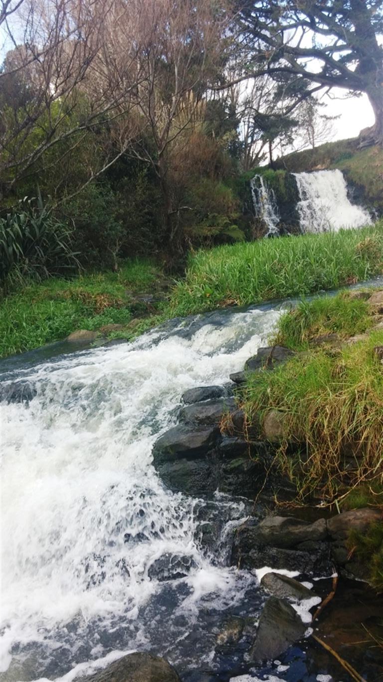 |
| Waitangi Falls |
Waitangi Falls |
 |
|
| Waikato River at Hoods Landing. Photo by John Heebink. |
|